Beit Lahia (Bayt Lāhyā)
Beit Lahia or Beit Lahiya (بيت لاهيا) is a city in the Gaza Strip north of Jabalia, near Beit Hanoun and the 1949 Armistice Line with Israel. According to the Palestinian Central Bureau of Statistics, the city had a population of 59,540 in mid-year 2006. Hamas political party is still administering the city, together with the entire Gaza Strip, after winning the 2005 municipal elections.
The word "Lahia" is Syriac and means "desert" or "fatigue". It is surrounded by sand dunes, some rise to 55 m above sea level. The area is renowned for its many large sycamore fig trees. The city is known for its fresh, sweet water, berries and citrus trees. According to Edward Henry Palmer, "Lahia" was from "Lahi", a personal name.
The word "Lahia" is Syriac and means "desert" or "fatigue". It is surrounded by sand dunes, some rise to 55 m above sea level. The area is renowned for its many large sycamore fig trees. The city is known for its fresh, sweet water, berries and citrus trees. According to Edward Henry Palmer, "Lahia" was from "Lahi", a personal name.
Map - Beit Lahia (Bayt Lāhyā)
Map


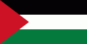
Country - Palestine
 |
 |
* State of Palestine, a state in Western Asia
Currency / Language
| ISO | Currency | Symbol | Significant figures |
|---|---|---|---|
| ILS | Israeli new shekel | ₪ | 2 |
| ISO | Language |
|---|---|
| AR | Arabic language |